Urbanization has improved the standard of living for many people in the country as it often brings in greater wealth and economic opportunities for the national population. But, unless these opportunities are well managed through balanced growth policies, it can leads to an increase in urban poverty, a rise in socio-economic inequality and informal settlements poorly served with basic services.
In recognition of the need to better address these issues, the Ministry of Lands and Survey (MLHS), has requested UN-Habitat support to undertake the urban profiling in the Solomon Islands.
The islands of Antigua, Barbuda and Redonda make up one nation. They are situated near the centre of the Caribbean archipelago, and are part of the Lesser Antilles and Leeward Islands groupings. They experience tropical maritime climate. There is little seasonal temperature variation, but there is usually an annual dry season that lasts from December to April and a wet season that spans from May to November. The average annual rainfall is around 1,150 millimetres (less than half that of Dominica?s or any of the other mountainous Caribbean islands), with periodic droughts (occurring roughly every seven years).
Antigua is the larger of the two main islands. It is roughly circular in shape, approximately 14 miles (22.5 kilometres) wide and 12 miles (19.3 kilometres) long with a jagged/indented coastline, and is 108 square miles and 280 square kilometres) in area. Antigua developed from a volcano that rose out of the sea about 34 million years ago, and differs from many other islands in that it contains both volcanic and limestone geological features. It is primarily divided into three geological regions: Northeast Limestone Highlands, Central Clay Plains and Southwest Volcanic Mountains/Hills/Valleys
The All Saints Urban Profiling consists of an accelerated, action-oriented assessment of urban conditions, focusing on priority needs, capacity gaps, and existing institutional responses at local and national levels. The purpose of the study is to develop urban poverty reduction policies at local, national, and regional levels, through an assessment of needs and response mechanisms, and as a contribution to the wider-ranging implementation of the Millennium Development Goals.
The study is based on analysis of existing data and a series of interviews with all relevant urban stakeholders, including local communities and institutions, civil society, the private sector, development partners, academics, and others. The consultation typically results in a collective agreement on priorities and their development into proposed capacity-building and other projects that are all aimed at urban poverty reduction. The urban profiling is being implemented in 30 ACP (Africa, Caribbean and Pacific) countries, offering an opportunity for comparative regional analysis. Once completed, this series of studies will provide a framework for central and local authorities and urban actors, as well as donors and external support agencies.
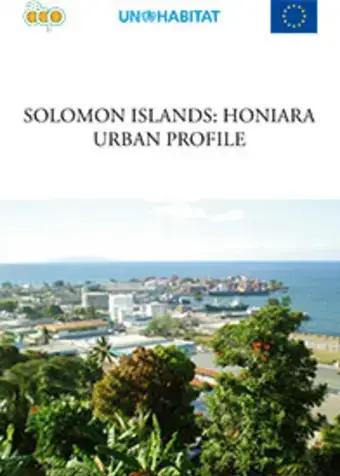
Honiara is the capital of Solomon Islands and is situated on Guadalcanal Island. It serves as the main administrative, educational and economic centre for the country. It has a population of just over 64,600 with an average density of 2,953 people per square kilometre. Honiara city was developed from the rubble of an American war base established during the Second World War, and has grown at a rate of 2.7 percent per annum over the years to become the primary city in the country. The city is made up of diverse ethnic groups and indigenous people.
The main economic activities in Honiara are in the services sector. Rising unemployment, poverty and high costs of living are common features in Honiara. Some residents, particularly those living in the informal settlements, are engaged in a range of informal economic activities.
Antigua and Barbuda: St. John's City Urban Profile , West Indies
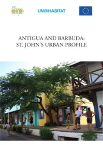
St. John’s, situated in Antigua, is the capital of the three-island nation of Antigua, Barbuda and Redonda. St. John’s City has a population of about 25,000 - 32% of the country’s total population. The next largest urban area in the country, All Saints Village, has a population of about 4,000; St. John’s is therefore a primate city. A primate city is defined as being “at least twice as large as the next largest city and more than twice as significant” [Mark Jefferson in 1939].
A primate city is number one in its country in most aspects, like politics, economy, media, culture, and education. St. John’s, at the head of a deeply indented harbour, is not only the residential capital of the country, but the commercial, entertainment and administrative centre as well. Tourism is important, and the harbour has been dredged to accommodate deep-draft (35 feet) cargo and cruise vessels. Because of the city’s British colonial past, it is blessed with a number of historic buildings and heritage sites which are important for heritage tourism, especially in light of the fact that most tourist cruise ships that visit the country dock in St. John’s Harbour and the tourists disembark directly into downtown St. John’s.
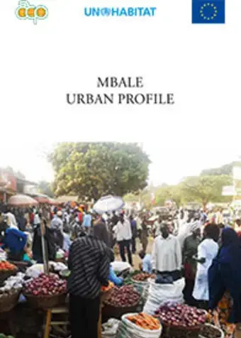
Mbale is a Municipality in Mbale District in the eastern part of Uganda. It began as a commercial centre for Arab slave traders and later attracted Indian traders who had come to East Africa to build the railway line. Eventually, Mbale became the Uganda Government’s administrative centre for the Eastern Uganda region.
The major challenges facing Mbale town are growth of informal human settlements, poor land records, lack of serviced land, poor land tenure systems, outdated structure plans, political interference in decision making, outdated laws, high urban population, and inadequate human resources.
Mbale Town is located on the foot of Wanale ridge of Mt. Elgon which is 8,000 feet above sea level. It covers a geographical area of 2,435 hectares. Mbale’s central location makes it attractive, competitive and a business hub in the region. Further its location and multiple entry points and its close proximity to Kenya makes it accessible to all regions and provides opportunities for enhanced trade activities that attract local investment necessary for economic development. Mbale town is experiencing typical problems associated with urban areas such as high population growth and unemployment, lack of basic urban services and inadequate waste management.
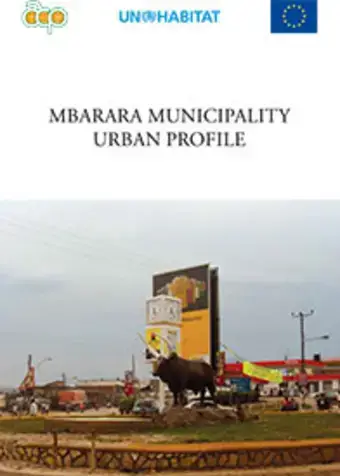
The Municipality of Mbarara is believed to have picked its name from a tall grass locally known as Emburara (Hyperemia ruffa) that covered the whole area. Its real commercial growth begun with the appearance of the Asian trader and by 1950, there were about 15 commercial premises operating in the town. More commercial enterprises were set up in 1950 and 1960. In 1957, it was declared a township authority under the British Administration at Kamukuzi, and elevated to Municipality Status in 1974.
The current economy of Mbarara Municipality is predominantly based on the social services sector, the informal sector activities, trade, and industry. Mbarara is the biggest town in the western part of Uganda and the second transit town between Rwanda and Uganda. Majority of people derive their livelihood from employment income (54.3 percent), business industry (26 percent), farming (7.1 percent), property (1.6 percent) and other incomes (10.9 percent), (Mbarara Municipality Three Year Rolling Development Plan, 2019/10-2011/12).
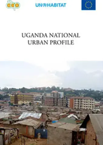
Uganda is a landlocked country, lying astride the equator in East Central Africa occupying 241,551 square kilometres, 18 percent of which is composed of inland waters and permanent wetlands. It is closely linked by economic and colonial history to Kenya in the east and Tanzania in the south. To the North and West lie the Sudan and Democratic Republic of Congo (DRC) respectively and further Southwest lies Rwanda.
The constitution of the republic of Uganda provides the overall legal basis for government to plan and implement government programmes for the country. The challenge of uplifting the livelihoods and quality of life of the people draws its impetus from international development commitments to which Uganda is party, and clearly pronounced in the Millennium Development Goals (MDG’s) whose targets are interfaced with Uganda’s shared vision, sector priorities and plans.
Kitgum Town is located in Chua County and is bordered by Labongo Layamo to the west and north and Labongo Amida to the east and south. The town is steadily recovering from a long civil war and its growth is mainly as a result of its close proximity to Sudan which has enabled a lot of cross border business. The neighbouring districts of Pader, Lira and Gulu also contribute to Kitgum’s steady growth. Kitgum houses the district headquarters and is the major commercial hub of Kitgum district. The topography of the town is best described by its gentle slopping plains and hills.
Kitgum lies at an altitude of 937 meters above sea level (at the bank of Pager River). The main problems affecting the town include overpopulation, unemployment, lack of basic urban services, poor waste management, and urban poverty. Another major problem affecting Kitgum town is haphazard development due to lack of a physical development plan. Nevertheless, Kitgum Town Council’s mission is to provide and facilitate quality service delivery and economic empowerment of the urban poor, and to ensure orderly infrastructure development of the town.
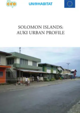
Rapid urban sector profiling studies have been undertaken in Solomon Islands by the Ministry of Lands, Housing and Survey with the support of UN‑Habitat and financed by the European Commission. To date, three city profiles for Honiara, Gizo and Auki have been completed and published.
The present report sets out the national urban profile, consisting of a general background and a synthesis of six themes: governance and institutional links, infrastructure development, informal settlements and housing, local economy and employment, urban land and planning and urban security and environmental safety.