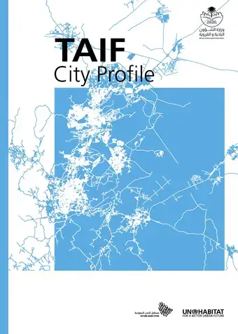
The Future Saudi Cities Programme is a joint programme developed by the Ministry of Municipal and Rural Affairs in Saudi Arabia and UN-Habitat, implemented in close cooperation with the municipalities of 17 major Saudi cities, the cities have been selected based on their different population sizes, geographic distribution, and a range of criteria based on capacities and economic potential to create a more
balanced regional development among the cities of Saudi Arabia. The chosen cities include Riyadh, Makkah, Jeddah, Taif, Madinah, Tabuk, Dammam, Qatif, Al-Ahsa, Abha, Najran, Jazan, Hael, Arar, AlBaha, Buraidah, and Skaka. one of FSCP outcomes is the city profiles.
The city-profile performs as a thinking tool that constitutes together an assessment tool and guidance for the current and future planning of the city, whilst defining a clear strategy for sustainable development. This tool is based on the UN-Habitat’s three-pronged approach considers spatial planning in relation to legal and institutional frameworks, in addition to financial mechanisms. In this way, success criteria for the sustainable implementation of a spatial plan should include flexible but enforceable rules and regulations, in addition to a financing strategy and projections. The City Profile Methodology, that is applied to Taif, is contenting the following steps:
1- Evidence based input approach.
2- The City reviews.
3- The City Prosperity Index assessment report.
4- The GIS spatial analysis.
This is UN-Habitat’s sixth and final annual progress report on the implementation of the strategic plan 2014—2019. The report presents an analysis of progress on indicators against set targets for each expected accomplishment over the Strategic Plan period (2014—2019). Key achievements and detailed results across all scales are presented. Impact stories demonstrate the concrete and practical ways that UN-Habitat has transformed the lives of beneficiaries.
The 2019 report highlights achievements in one of UN-Habitat’s key areas of strength, transformative normative tools and knowledge products. These are providing important norms and standards that are strengthening member states’ capacity to deliver sustainable urbanization. The Secretary-General’s Guidance Note on Land and Conflict, the Safer Cities Guidelines and the Urban-Rural Linkages Guiding Principles and Framework, for example, are setting principles for the global community on sustainable urbanization planning, how to leverage the urban-rural divide for strengthened sustainable urbanization and guidelines for making cities safer. Harmonized methodologies to guide the Sustainable Development Goals global monitoring of sustainable urbanization were developed, such as the definition of cities and refining the slum area-based definition to improve its clarity and relevance.
Robust results and impacts were realized from programmatic work across some subprogrammes. The Planning Lab, for example, continues to provide technical support to member states on planning and design for inclusive, compact and integrated cities. Through the Public Space programme made cities more inclusive for some 445,000 people—many of whom are girls and women, in 2019 alone.
UN-Habitat is also making a unique contribution to humanitarian and post-conflict settlement planning through the integrated and inclusive urban tools that deliver sustainable change to beneficiaries.
UN-Habitat’s resilience profiling and planning tools successfully supported cities to become more climate-resilient in Africa, Asia and Pacific regions. The reconstruction and resilience work in Mozambique, undertaken through the school’s programme to strengthen their structures, for example, demonstrated the benefits of cyclone resilient designs. The Global Land Tool Network, which uses an inclusive approach to tenure security through the continuum of land rights, has expanded tenure security for over 300,000 households (approximately 1.2 million people) in 13 countries over the past six years.
Important institutional milestones were achieved in 2019. The first UN-Habitat Assembly was successfully held 27th - 31st May 2019. The Assembly approved the new Strategic Plan 2020—2023. In 2019, a new organization structure was developed and approved by the Executive Board and its implementation commenced in January 2020.
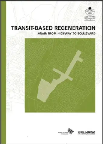
The Future Saudi Cities Programme is a joint programme developed by the Saudi Ministry of Municipal and Rural Affairs and UN-Habitat, implemented in close cooperation with the municipalities of 17 major Saudi cities, the cities have been selected based on their different population sizes, geographic distribution, and a range of criteria based on capacities and economic potential to create a more balanced regional development among the cities of Saudi Arabia. The chosen cities include Riyadh, Makkah, Jeddah, Taif, Madinah, Tabuk,Dammam, Qatif, Al-Ahsa, Abha, Najran, Jazan, Hael, Arar, AlBaha, Buraidah, and Skaka. one of FSCP outcomes is the three demonstration projects for three cities (-Al-Ahsa, Arar and Buraidah).
UN-Habitat’s three-pronged approach considers spatial planning in relation to legal and institutional frameworks, in addition to financial mechanisms. In this way, success criteria for the sustainable implementation of a spatial plan should include flexible but enforceable rules and regulations, in addition to a financing strategy and projections. As a pragmatic explication of this approach, three local demonstration projects representing essential elements of a strengthened and improved planning system have been developed. As applicable to all of these projects, the demonstration project for Arar has been elaborated to include schematic designs and feasibility studies, that can later be transformed into implementation plans. Such implementation plans are projected to be undertaken by the Ministry of Municipal and Rural Affairs (MoMRA), in collaboration with other partners in the Kingdom. Though this project is localised in order to provide a detailed and calculated projection of impact, it has been designed to address problems that have been analysed as paradigmatic of Saudi cities, and the themes and elemental compositions presented here, are considered as transposable in the larger Saudi context. The project addresses themes such as compaction and densification, connectivity, circulation hierarchies, equitable access to infrastructure, and transport and facilities.
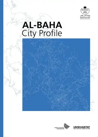
The Future Saudi Cities Programme is a joint programme developed by the Ministry of Municipal and Rural Affairs in Saudi Arabia and UN-Habitat, implemented in close cooperation with the municipalities of 17 major Saudi cities, the cities have been selected based on their different population sizes, geographic distribution, and a range of criteria based on capacities and economic potential to create a more balanced regional development among the cities of Saudi Arabia. The chosen cities include Riyadh, Makkah, Jeddah, Taif, Madinah, Tabuk,Dammam, Qatif, Al-Ahsa, Abha, Najran, Jazan, Hael, Arar, AlBaha, Buraidah, and Skaka. one of FSCP outcomes is the city profiles.
The city-profile performs as a thinking tool that constitutes together an assessment tool and guidance for the current and future planning of the city, whilst defining a clear strategy for sustainable development. This tool is based on the UN-Habitat’s three-pronged approach considers spatial planning in relation to legal and institutional frameworks, in addition to financial mechanisms. In this way, success criteria for the sustainable implementation of a spatial plan should include flexible but enforceable rules and regulations, in addition to a financing strategy and projections. The City Profile Methodology, that is applied to AlBaha, is contenting the following steps:
Urban Chances, City Growth and The Sustainability Challenge: A Research Dissemination Report
Urban Chances, City Growth and The Sustainability Challenge: Chance2Sustain is a research programme that examined how governments and citizens in cities with differing patterns of urban economic growth make use of participatory (or integrated) spatial knowledge management to direct urban governance towards more sustainable development. Participatory spatial knowledge management is the main concept used to study this issue, as it reflects a strategic resource, which all stakeholders can contribute to urban governance processes towards sustainable development.
It includes both expert knowledge and several forms of non-expert knowledge, such as knowledge from (working) experience (tacit), embedded sectoral knowledge, and social (or community-based) knowledge at the neighbourhood and city-wide level. Participatory processes of urban planning and management are strategic in eliciting these forms of spatially disaggregated (of specific) knowledge, which are usually not acknowledged in topdown, expert-driven models of urban governance and planning. Utilizing participatory spatial knowledge can make urban governance and planning more effective and gain wider acceptance, by incorporating both expert and local community knowledge. Although participatory spatial knowledge management is increasingly used in urban planning processes, its success depends on external political and economic conditions.
A legal framework providing for fiscal decentralisation and funding, for instance, is a strategic support. The influence of various external conditions has not yet been analysed much locally, and certainly not comparatively across different socio-political contexts, although it is a strategic question, given the inherent trade-offs and potential political conflicts in combining environmental, social and economic goals (within sustainable development). Therefore, the programme focused on ten cities with contrasting economic and political conditions, with the main scientific objective of developing a model on participatory spatial knowledge management to direct urban governance to sustainable development.
The United Nations Human Settlements Programme (UN-Habitat) was a dissemination partner for the research programme. This report summarizes the findings of the research and contains two policy briefs targeted at policy makers and practitioners.
City-Wide Public Space Strategies: A Compendium of Inspiring Practices
Public space is more than well designed physical places. It is an arena for social interaction and active citizenship that can spark social and economic development and drive environmental sustainability. The design, provision and maintenance of well connected systems of public space are integral to achieving a safe and accessible city. However, cities must move beyond typically site-specific approaches to addressing public space if sustainable and longer lasting benefits are to be achieved. Establishing and implementing a city-wide strategy that approaches a city as a multi-functional and connected urban system can ensure the best chances of proactively driving good urban development.
A thorough strategy offers cities an action-oriented approach encompassing not only spatial goals, but governance arrangements, implementation plans, budgetary needs and measurable indicators. It should be formulated to overcome common obstacles to the successful provision of public spaces throughout a city. With adequate political support and funding, a city-wide public space strategy can deliver a well-distributed, accessible and inclusive public space system.
City-Wide Public Space Strategies: a Compendium of Inspiring Practices offers summaries and assessments of 26 such strategies from different cities in all regions of the world. It also proposes a new set of typologies of strategies and a framework with which strategies can be evaluated. This compendium is complemented by City-Wide Public Space Strategies: a Guidebook for City Leaders and together they provide city leaders, including mayors, local authorities, urban planners and designers, with the knowledge and tools necessary to support them in developing and implementing city-wide public space strategies. Building on the Global Public Space Toolkit published by UN-Habitat in 2016, this set of publications supports the strengthening of local government capacity, providing actionable policy guidance and driving transformative change in multiple global contexts.
City-Wide Public Space Strategies: A Guidebook for City Leaders
Public space is more than well designed physical places. It is an arena for social interaction and active citizenship that can spark social and economic development and drive environmental sustainability. The design, provision and maintenance of well connected systems of public space are integral to achieving a safe and accessible city. However, cities must move beyond typically site-specific approaches to addressing public space if sustainable and longer lasting benefits are to be achieved. Establishing and implementing a city-wide strategy that approaches a city as a multi-functional and connected urban system can ensure the best chances of proactively driving good urban development.
A thorough strategy offers cities an action-oriented approach encompassing not only spatial goals, but governance arrangements, implementation plans, budgetary needs and measurable indicators. It should be formulated to overcome common obstacles to the successful provision of public spaces throughout a city. With adequate political support and funding, a city-wide public space strategy can deliver a well-distributed, accessible and inclusive public space system.
City-Wide Public Space Strategies: a Compendium of Inspiring Practices offers summaries and assessments of 26 such strategies from different cities in all regions of the world. It also proposes a new set of typologies of strategies and a framework with which strategies can be evaluated. This compendium is complemented by City-Wide Public Space Strategies: a Guidebook for City Leaders and together they provide city leaders, including mayors, local authorities, urban planners and designers, with the knowledge and tools necessary to support them in developing and implementing city-wide public space strategies. Building on the Global Public Space Toolkit published by UN-Habitat in 2016, this set of publications supports the strengthening of local government capacity, providing actionable policy guidance and driving transformative change in multiple global contexts.
The Global Public Space Programme: Annual Report 2019
In 2012, UN-Habitat launched its Global Public Space Programme, now active in more than 75 cities across the world, with the objective to promote public spaces as a keystone for sustainable cities in order to ensure good quality of life for all.
The Global Public Space Programme is a consolidated and integrated approach to public space improvement across UN-Habitat. Over the last seven years, we have developed an iterative approach to public space that includes a variety of normative and operational tools, methodologies and practices that support local and national governments and other partners to make public spaces more safe, inclusive, accessible and green. This includes public space assessments, policy guides, strategies and design principles, capacity building, participatory tools, technology and innovation projects and carrying out advocacy work and actual implementation.
Together with local government and civil society partners, the programme has implemented more than 105 concrete public space upgrading projects selected through annual expressions of interests. Our work has been proven to be effective in achieving social, economic and environmental benefits. The good policy and practices that we have on a global level is shared through a network of more than hundred partner organizations.
Financing Sustainable Urbanization: Counting the Costs and Closing the Gap
While we know that cities can be drivers for the achievement of Agenda 2030, lack of sufficient finance for investment in infrastructure and sustainable development prevents urban populations from reaching their full potential and increases the overall costs of municipalities. One obstacle for unleashing adequate finance is that there is a lack of understanding on the basic costs of a city. This necessitates a comprehensive costing estimation for SDG 11 on sustainable urbanization.
There is also a lack of capacity to cover such costs, partly stemming from inadequate awareness of the total financing capacity currently available and how to access it. This report presents an innovative pilot on how to count the costs for achieving SDG 11 developed by UN-Habitat and AidData. It furthermore presents UN-Habitat estimations on the total SDG and infrastructure investment gap as well as the total private and public financing capacity available. Finally, the report discusses possibilities for bridging the investment gap for SDG 11 and urban infrastructure, with a special emphasis on how local governments can access the currently underutilized institutional investor capacity.